


Vintagetalli
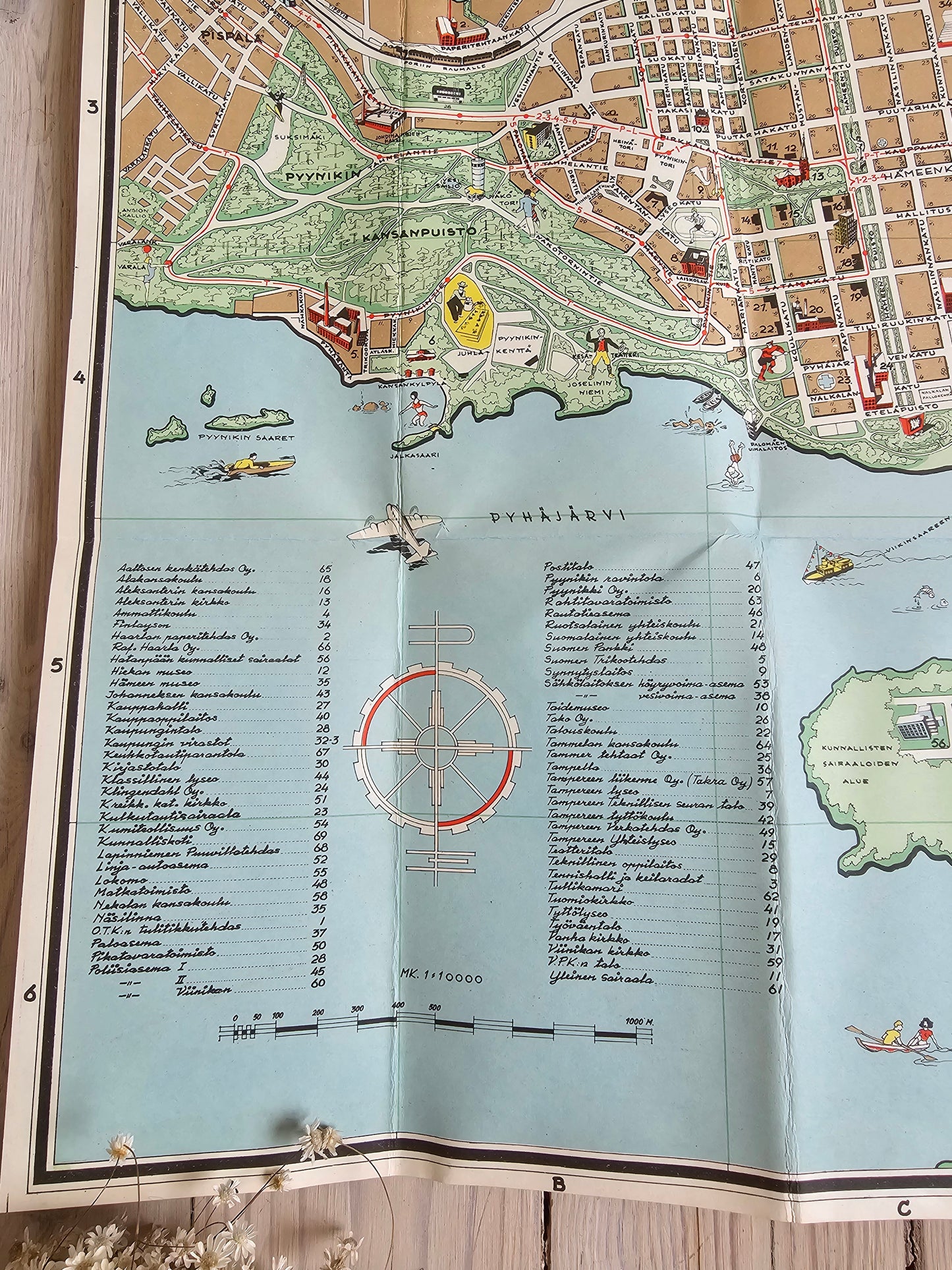
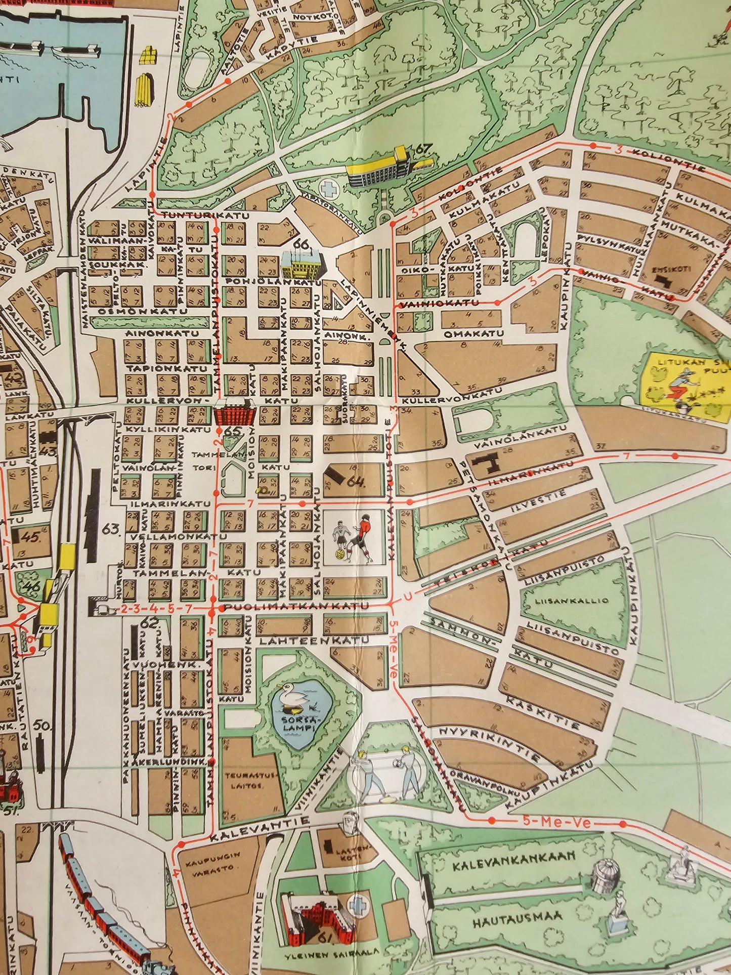
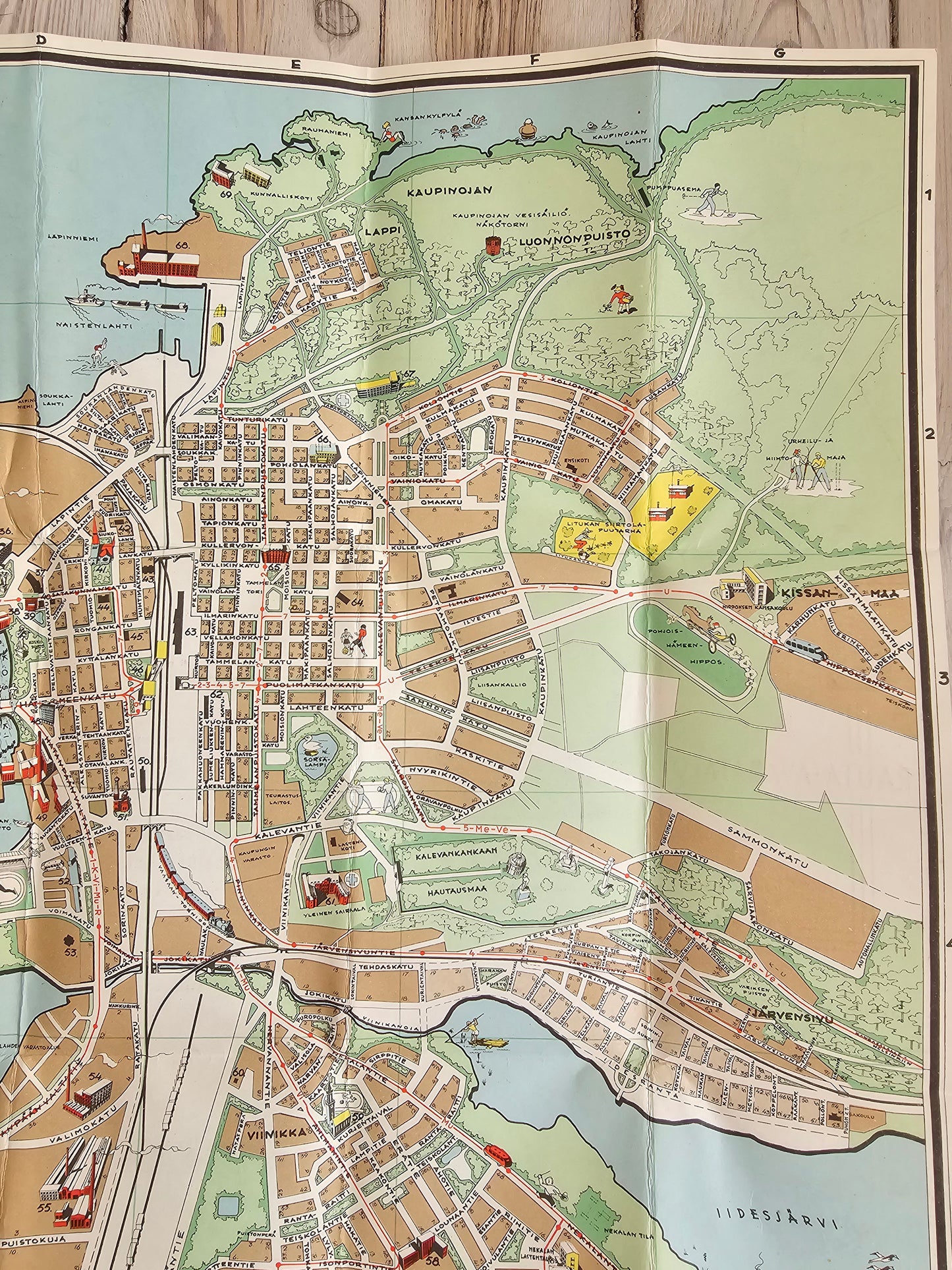
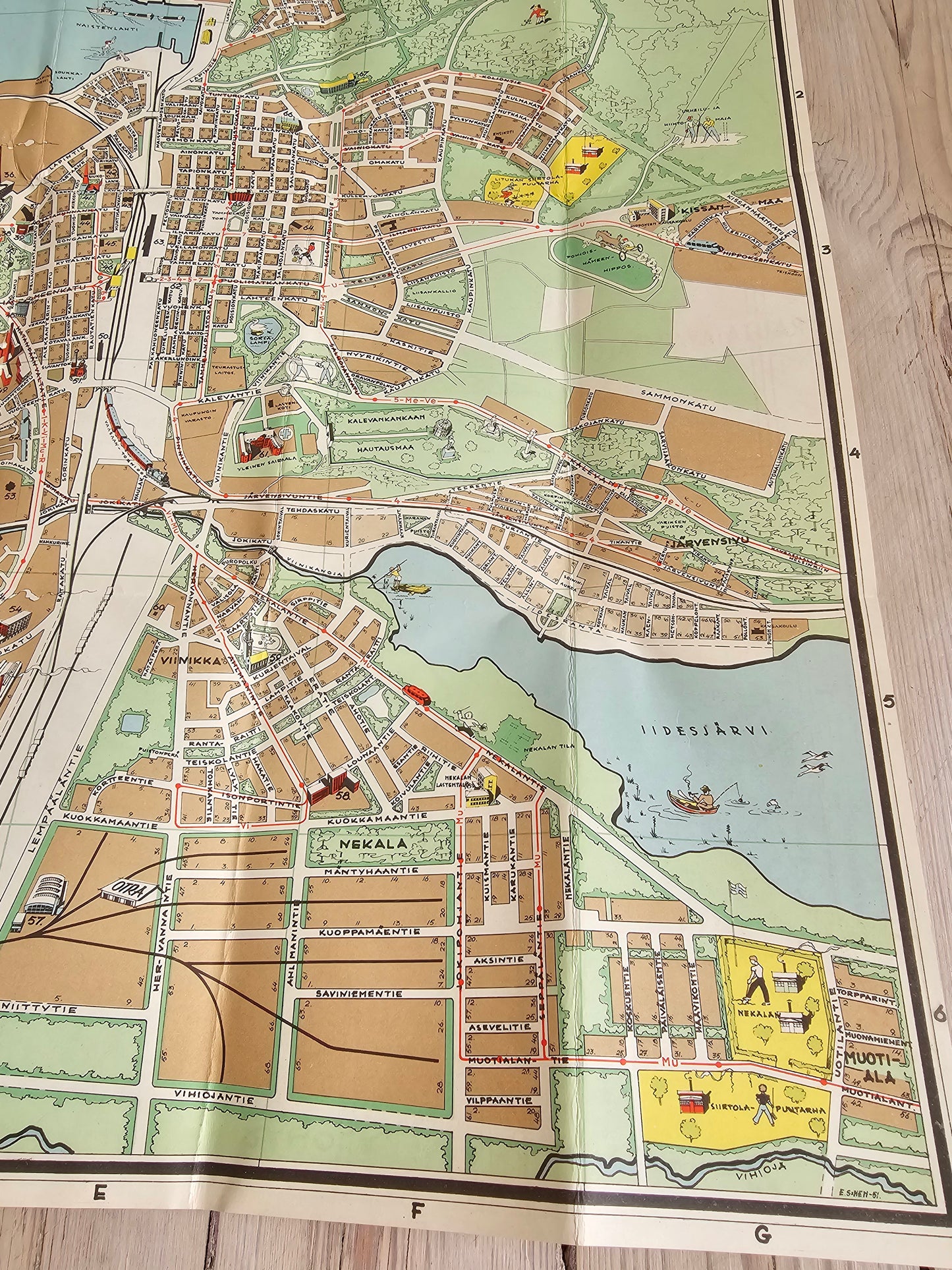
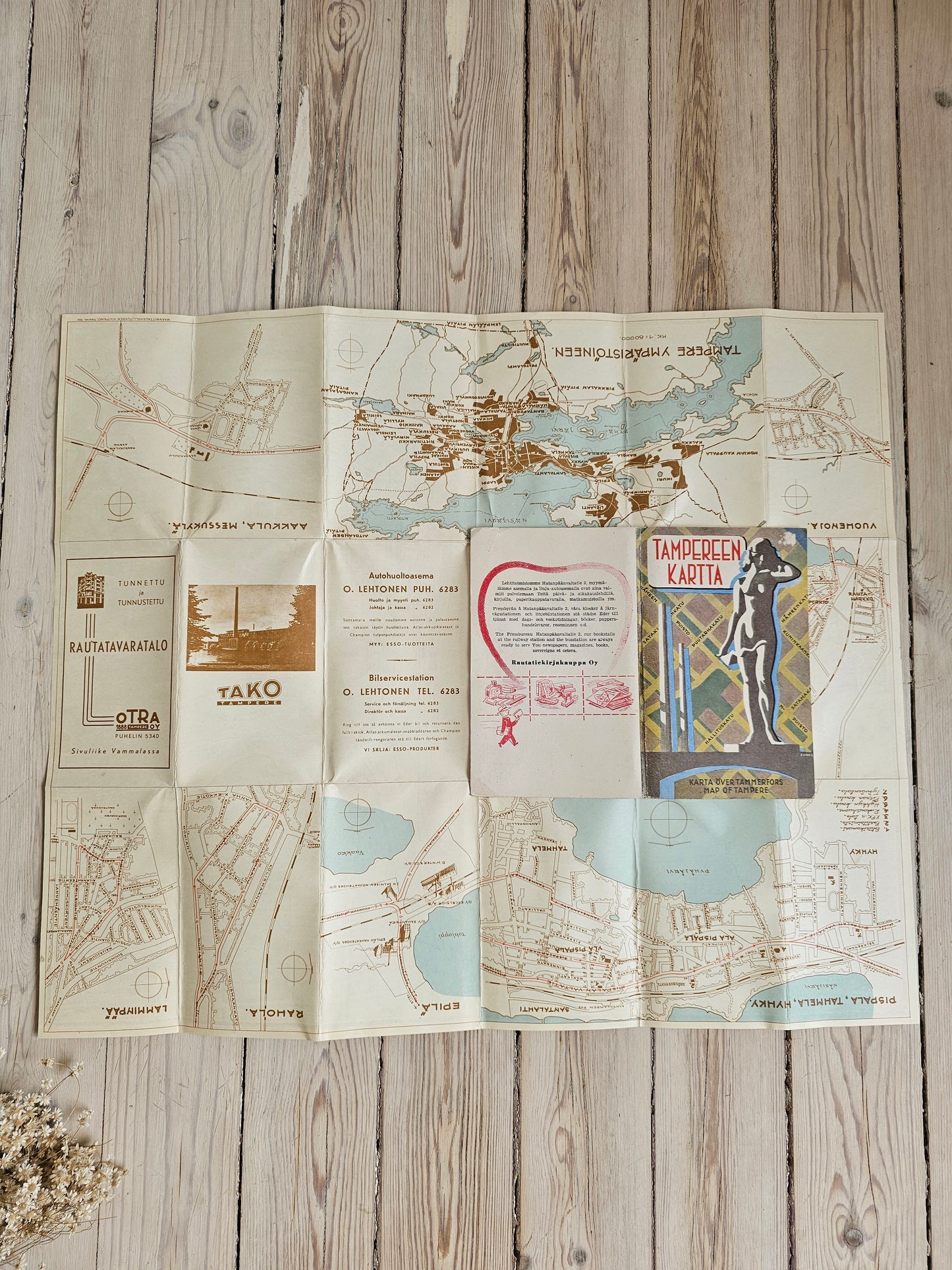
Map of Tampere 1951
Map of Tampere 1951
Couldn't load pickup availability
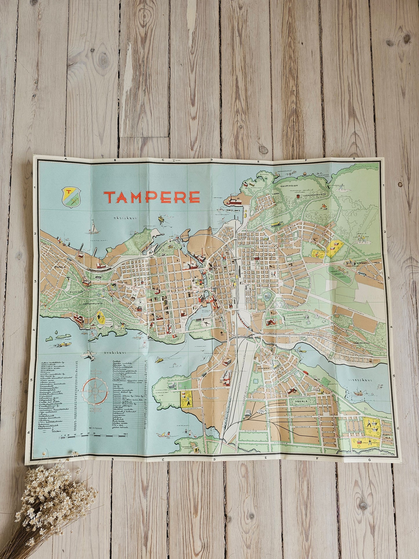
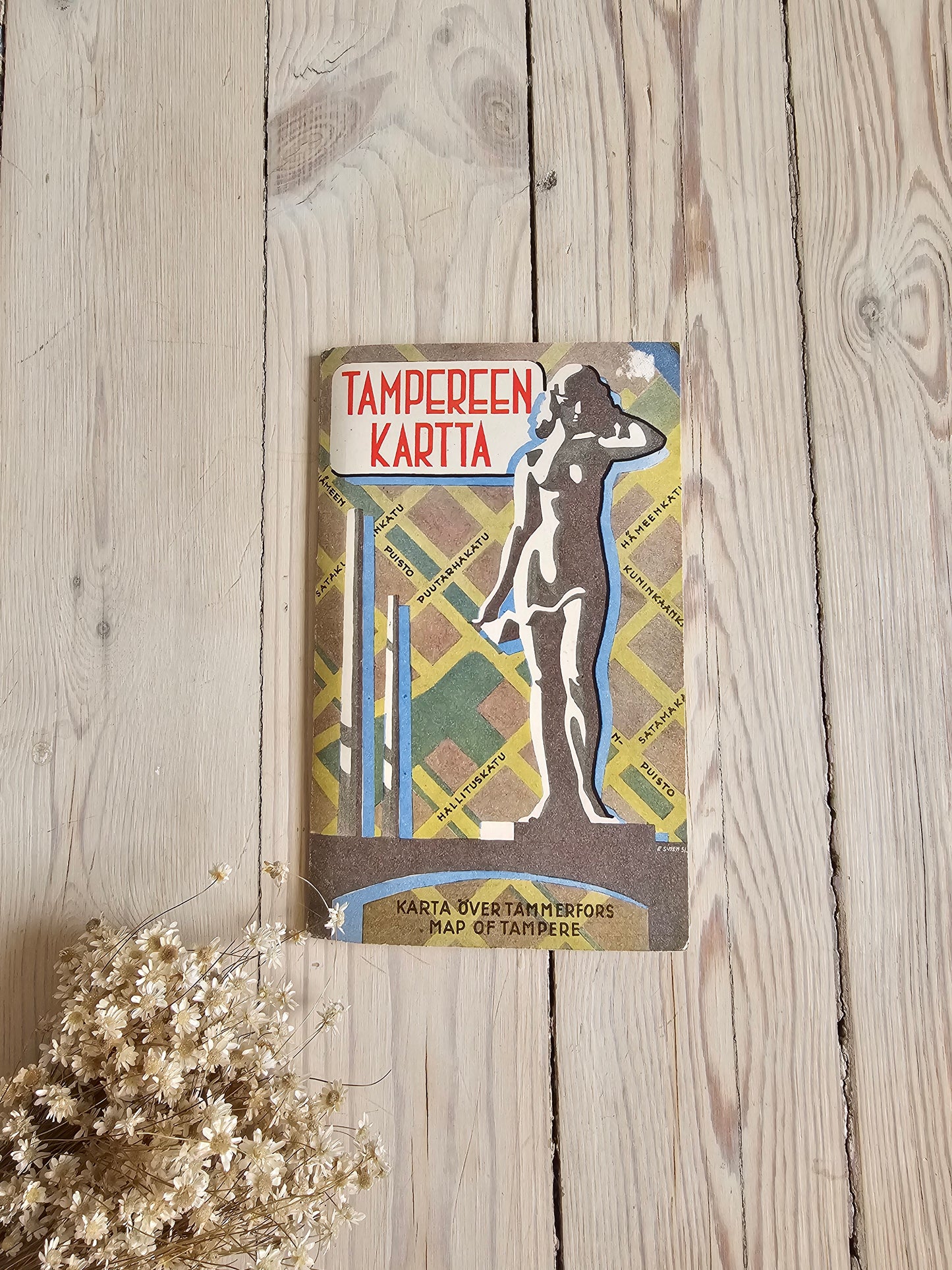
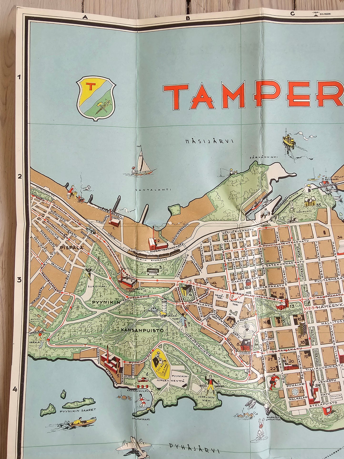
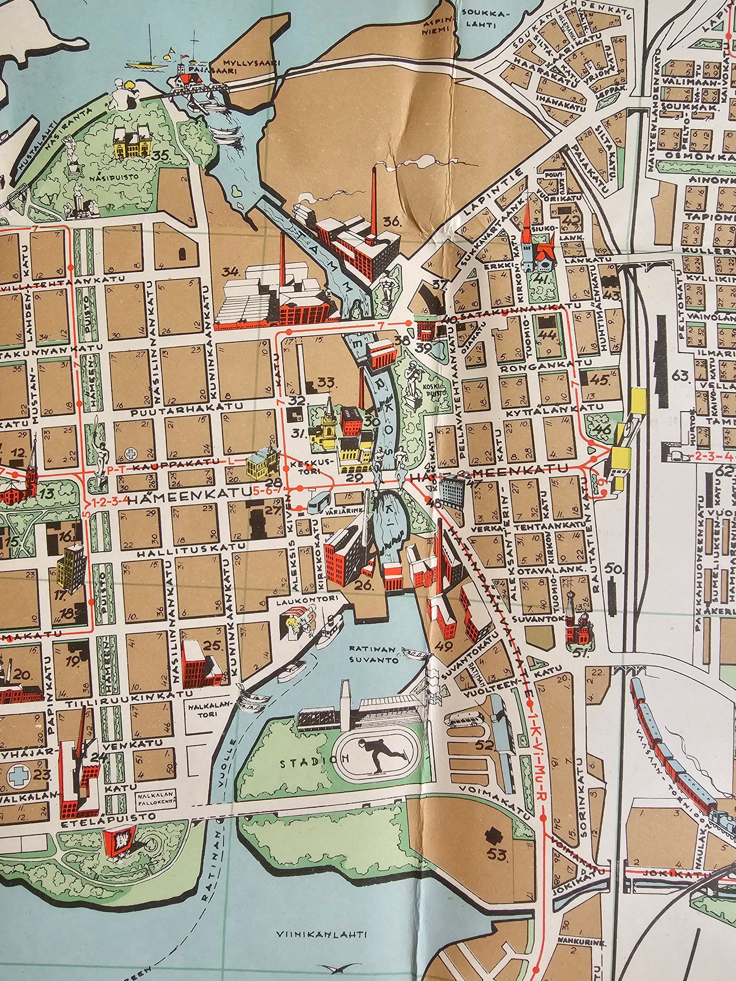
Old map of Tampere from 1951. The map is foldable and double-sided. On the reverse side, there are small areas around Tampere.
In the lower corner of the map, the text "Maanmittaulaitoun Kivipaino Helsinki 1951", which tells you the year the map was printed and the printer.
The map has beautiful colors and is in really neat condition.
Framed, a wonderful picture for the wall of a Tampere home!
Width: 52.5 cm
Height: 47 cm
Pick up or mail?
Now you can also pick up the products from us! When mailing, postage costs (€6.90) are added to the price at checkout. You can order several products for the same postage. If you want your shipment to arrive at a specific Posti pick-up point, please let us know in the comment field of the shopping basket.